
Fuji X-T1 and XF 18-55mm R LM OIS Lens

Fuji X70 – 1/750 @ f/11 – ISO 200
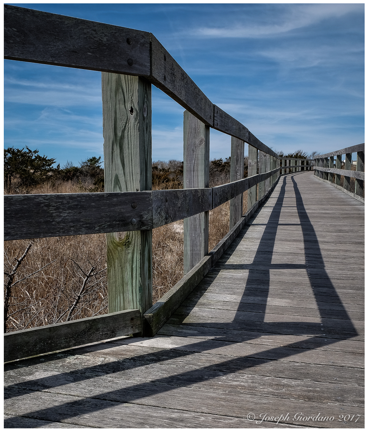
A cold January morning at Robert Moses State Park

Fuji X-T1 and XF 10-24mm OIS LM R Lens – 1/1600 @ f/5.6 – ISO 200

Fujifilm X-T1 and Fujinon XF 14mm f/2.8 Lens – 1/750 @ f/8.0 – ISO 200

Fujifilm X-T1 and Fujinon XF 55-200mm R OIS Lens – 1/4000 @ f/8 – 200mm – ISO 200
I was down at the beach early to catch some sunrise photos and on my way back to the car walking up the boardwalk I suddenly had a feeling I should turn around. This is what I saw shining through the vegetation on the sand dunes.
Nikon D600 and Nikon 24-85mm AF-S G VR Lens – 1/160 a f/11 – ISO 100
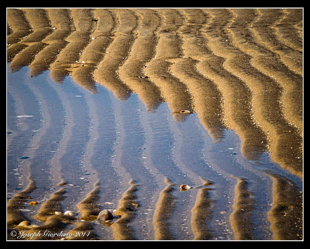
Repeating patterns in the sand after high tide on the North Shore of Long Island. I hope you enjoy.
Nikon D600 and Nikon 24-85mm AF-S G VR Lens – 1/500 @ f/8.0 – ISO 200
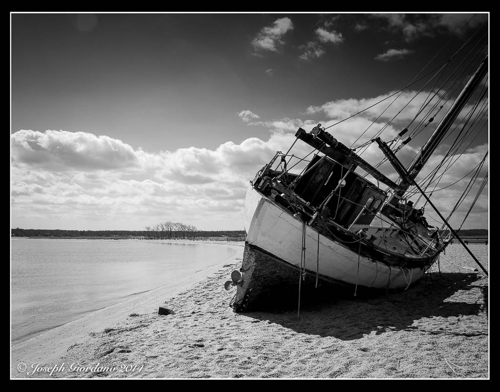
Shipwrecked in Centerport harbor. I hope you enjoy.
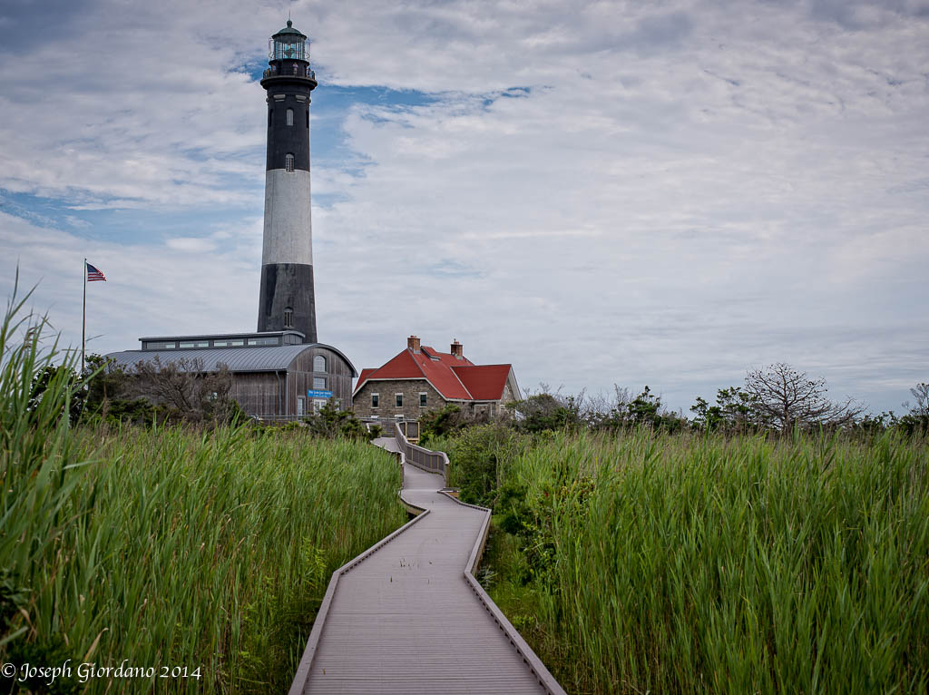
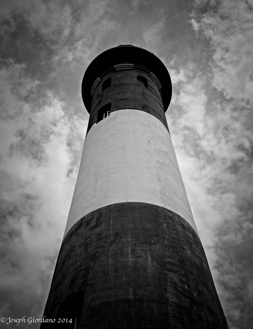
One would think being I have lived on Long Island for my entire life I might have been to the top of the Fire Island Lighthouse. Well I have not, but today I’m going to achieve that goal. I have been to the top of the Montauk Point Lighthouse and that one is a little claustrophobic for a portly gent like myself.
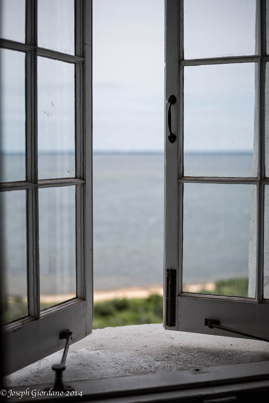
I am happy to say the spiral staircase is in great condition and there are ample handrails. This window is on the third landing and faces North toward the Great South Bay. That should be the town of Islip in the distance.
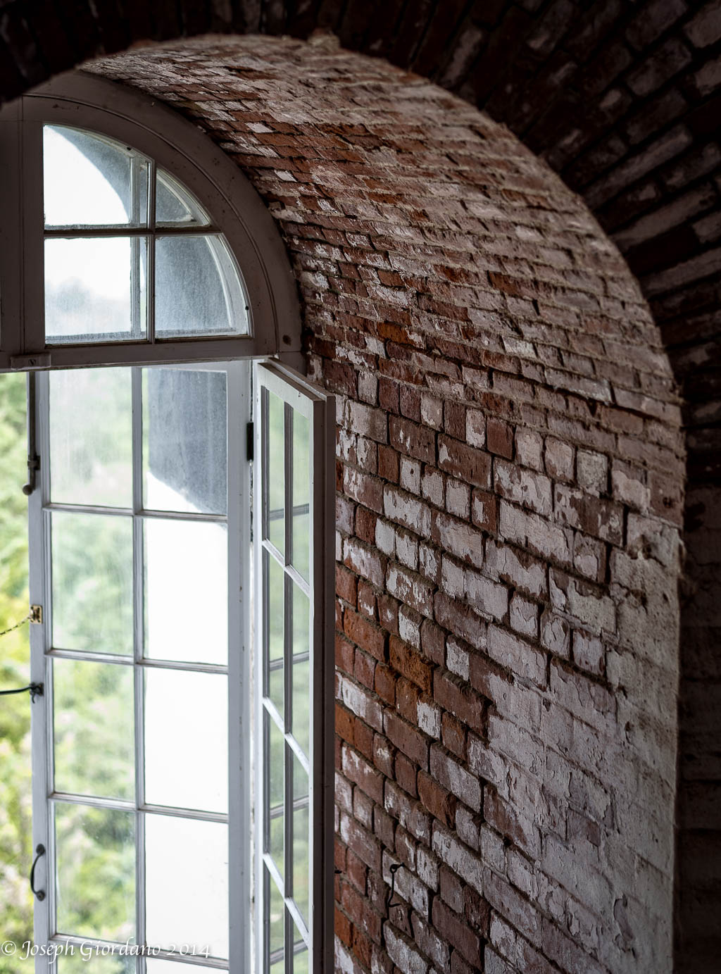
The thickness of the walls at the first floor landing were designed to be well over six feet thick. As you get higher the walls decrease in thickness and the tower gets narrower.

This window is facing south towards the Atlantic Ocean I guess you can call this the money view. It’s also the side of the building that gets hit really hard during the coastal storm and hurricane season.

This is the view from the top of the lighthouse facing West toward Robert Moses State Park and parking fields four and five. In the distance you can see the “Needle” water tower and the massive antenna to the right at the United States Coast Guard Station at Fire Island. The Atlantic Ocean is to the left and the Great South Bay to the right.

This is the view to the East and the communities seen in the distance are Kismit and Saltaire. Ocean Beach and Ocean Bay Park are a little bit further east. Beyond the lighthouse no vehicle traffic is allowed except for emergency vehicles. The Atlantic Ocean is to the right and the Great South Bay to the left.
For a compete history of this historic landmark please go to this link – http://www.fireislandlighthouse.com/html/lighthouse_history.html
Fujifilm X-E2 and Fujinon XF 55-200 R OIS Lens – 1/1000 @ f/4.8 – 200mm – ISO 200
Will you hold on a minute please I just got a text :) I hope you enjoy.

